The Namparang Trail: Islands, Not Beaches
Last verified: 2026-09-07. Rules and prices change — always confirm on the official site before you travel.
This page contains affiliate links. If you book through them we may earn a commission at no extra cost to you. It never changes what we recommend.
Namparang-gil (남파랑길) runs 1,470 km along Korea’s entire south coast, from Oryukdo in Busan to Ttangkkeut Tower in Haenam, across 90 numbered courses. It’s the second-longest of the four trails making up the Korea Trail, and the one built around islands rather than a single coastline — the south coast is where Korea’s mainland breaks apart into hundreds of them, and the trail spends most of its length picking a way between bays, ports and island crossings instead of a straight shore.
Where it starts, and what it shares with the other trails
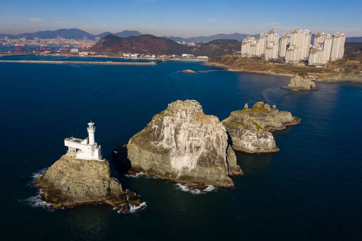
The trail begins at Oryukdo, a chain of rock islets a short walk from Oryukdo Skywalk — a glass-floored platform built in 2013, 35 meters above the water. Oryukdo means “five-six islands,” a name that comes from how many islets are visible depending on the tide and the angle. It’s a double starting line: Haeparang-gil, the east-coast trail, also begins here, running north while Namparang-gil heads west and south.
Namparang-gil ends at the same tower where Seohaerang-gil, the west-coast trail, begins — Ttangkkeut Tower in Haenam, the Korean mainland’s actual southernmost point. Our Seohaerang-gil guide covers that end of the connection.
Where the Namparang Trail concentrates: Geoje
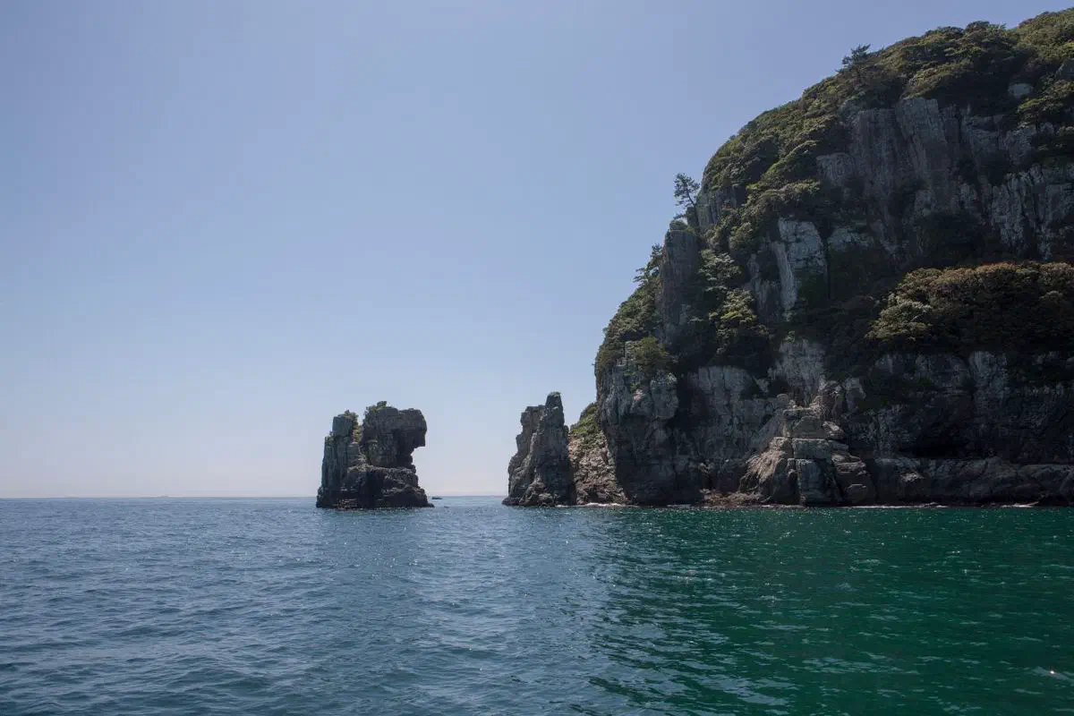
If one stretch of Namparang-gil deserves a dedicated trip rather than a single course, it’s Geoje, which alone holds twelve courses (courses 16 through 27) — the largest single-region cluster on the entire trail. Course 23, running from Hakdong Pass to Jeogu Port, passes directly by Windy Hill (바람의 언덕) and Haegeumgang (해금강), a cluster of sea-carved rock islets designated Scenic Site No. 2 — Geoje’s two most-photographed spots, both reachable on foot from the trail itself rather than requiring a separate car trip.
What the trail is actually built around
Namparang-gil spends roughly a third of its length — from around Goseong through Tongyeong, Geoje, Sacheon, Namhae and Hadong to Yeosu — inside or alongside Hallyeohaesang National Park, designated in 1968 as Korea’s second national park and its first marine one. The park runs from Jisimdo, off Geoje, to Odongdo in Yeosu, covering 510.3 km² across six coastal municipalities. Unlike Seohaerang-gil, where the tidal flat itself is the subject, Namparang-gil’s defining feature is this park: a coastline made almost entirely of islands, bays and fishing ports rather than open shore.
- Haeparang-gil (east)
- Beaches and coastal cliffs — the scenic, photogenic sibling
- Namparang-gil (south)
- Islands and fishing ports — built around Hallyeohaesang National Park
- Seohaerang-gil (west)
- Tidal flats and low horizons — the one where the sea itself changes shape twice a day
Each region along the way carries its own theme rather than repeating the last one: Busan’s first five courses run through old dialect and back-alley neighborhoods, Changwon’s cherry blossoms give way to Tongyeong and Goseong’s oyster coast, Yeosu closes its stretch with buskers on the night waterfront, and Boseong–Goheung runs a genuinely remote, dark-sky stretch of coast road.
Getting there and finding your way
The official Durunubi app carries GPS-tracked course maps and an electronic stamp tour across all four Korea Trail routes, the same as on Seohaerang-gil. A Korean eSIM keeps it usable on the ground; our map app guide covers the rest. Most courses connect to a KTX station or intercity bus stop at one end — Busan, Tongyeong, Yeosu and Suncheon all have direct KTX or express-bus links from Seoul; our intercity bus guide covers booking a seat out to the smaller ones.
Stays around Tongyeong work well as a base for the Goseong–Tongyeong and Geoje clusters together; Yeosu and Busan both have their own much larger hotel stock if you’d rather anchor the trip at either end.
Quick answers
How long is the Namparang Trail?
Where does the Namparang Trail start?
What's the best single stretch of the Namparang Trail?
How is Namparang-gil different from Haeparang-gil or Seohaerang-gil?
Checked 7 September 2026. Trail length, course count, and the Oryukdo start point from Durunubi’s official Namparang-gil introduction and course listing, including the regional course-range breakdown (Busan 1–5, Geoje 16–27, Yeosu 52–60, etc.). Oryukdo’s Scenic Site No. 24 designation and the Skywalk’s 2013 opening from Korean tourism-board and travel-press coverage of the site. Course 23’s route past Windy Hill and Haegeumgang from Geoje city’s own Namparang-gil course guide and Korean hiking-blog course reports; Haegeumgang’s Scenic Site No. 2 designation from Korea Tourism Organization listings. Hallyeohaesang National Park’s 1968 designation, its status as Korea’s first marine national park, and its 510.3 km² extent from the Korea National Park Service’s own park introduction. Course conditions and waymarking change — confirm on Durunubi before you set out.