Hiking Near Seoul, Sorted by Difficulty
Last verified: 2026-09-15. Rules and prices change — always confirm on the official site before you travel.
This page contains affiliate links. If you book through them we may earn a commission at no extra cost to you. It never changes what we recommend.
“K-hiking” covers an enormous range of actual difficulty, and most coverage of the trend doesn’t sort it out. A 30-minute walk to N Seoul Tower and a two-day ridge traverse across Jirisan both get called “hiking in Korea,” and a visitor who shows up for the first expecting the second — or the other way around — has a bad afternoon.
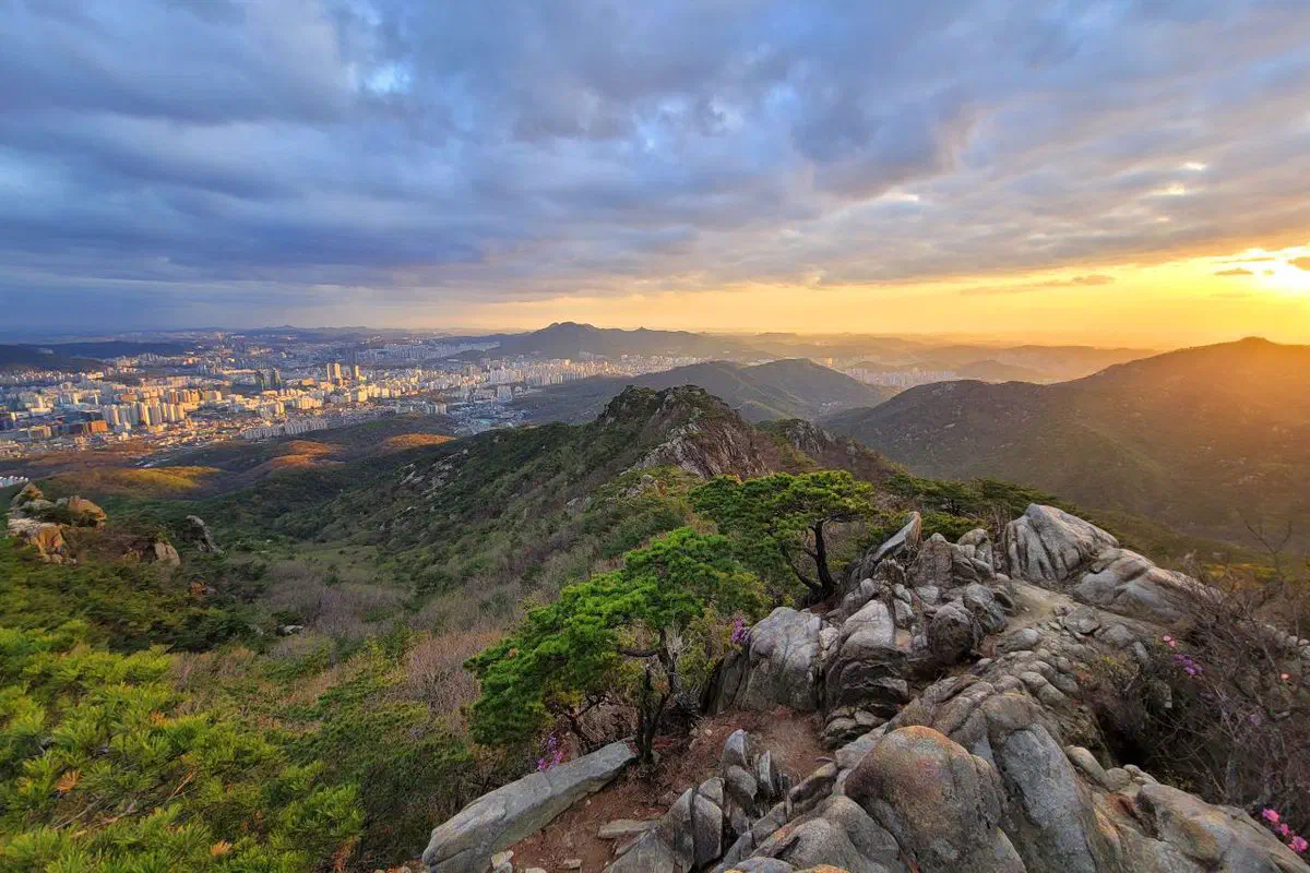
This page sorts nine hikes into three tiers by what they genuinely demand: time, elevation gain, and footwear. Within each tier, the mountains are ordered easiest to hardest.
- Namsan
- Tier 1 · 262 m · 1–2 hr round trip · sneakers are fine
- Achasan
- Tier 1 · 287 m · ~1.5 hr round trip · sneakers are fine
- Gwanaksan
- Tier 2 · 632 m · 3–4 hr round trip · real hiking shoes
- Cheonggyesan
- Tier 2 · ~583 m (public summit) · 2–3 hr round trip · real hiking shoes
- Bukhansan
- Tier 3 · 836 m · half day to a full day · hiking boots
- Songnisan
- Tier 3 · 1,058 m · ~4 hr round trip to the popular peak · hiking boots
- Seoraksan
- Tier 3 · 1,708 m · full day · hiking boots
- Hallasan
- Tier 3 · 1,947 m · full day, reservation required · hiking boots
- Jirisan
- Tier 3 · 1,917 m · full day, or two on the ridge traverse · hiking boots
Tier 1: an afternoon, sneakers are fine
Nothing here requires trail shoes, a walking pole, or more than a couple of hours. Both of these are closer to a scenic city walk than a mountain climb.
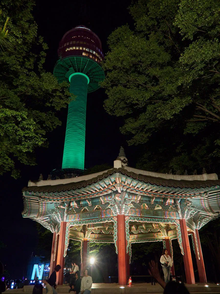
Namsan (262 m). From Myeongdong Station (Line 4), Exit 3, the stepped path to the summit takes 30–40 minutes each way — call it 1–2 hours round trip if you stop to look around. The reward is N Seoul Tower itself; a cable car also runs from near the same exit if you’d rather skip the stairs entirely. Namsan is less a hike than a landmark with a hill attached, and the numbers show it: Seoul’s own 2025 tourism data counts an average of 57,370 visitors a day, and 55.7% of them foreign — the highest foreign share of any hike on this page, by a wide margin. Go before noon or near sunset to get ahead of the crowds, and expect the heaviest traffic during cherry blossom season (early April) and peak autumn color (the last week of October).
Achasan (287 m). From Achasan Station (Line 5), Exit 2, it’s about a 10-minute walk to the trailhead and roughly 1.5 hours round trip to the main viewpoint — some sources log the walk up alone at closer to 30 minutes. The payoff is a sunset view over the Han River and the Seoul skyline that’s become genuinely popular on social media; expect the viewpoint to fill up around golden hour, especially on weekends. Achasan doesn’t have Namsan’s raw numbers, but it has the fastest growth of any hike on this page: foreign visitors were up 11.8% year over year in the same 2025 dataset, the highest increase of the four Seoul mountains Seoul tracks.
Tier 2: real hiking, real shoes
Both of these are genuine hikes — real elevation gain, real trail surface, and stretches where sneakers stop being a good idea. Budget half a day.
Gwanaksan (632 m). Difficulty depends heavily on which side you climb. From Gwanaksan Station (Sillim Line), Exit 1 — where the mountain’s free gear rental center is also located — the route toward the summit is a moderate climb. From Sadang Station, Exit 4, the ridge route past Hamabawi and Madangbawi runs over granite boulders with fixed ropes and chains on the steepest pitches; this side is genuinely advanced, not moderate, and hiking shoes stop being optional. The summit itself, Yeonjudae, is a Buddhist hermitage built directly onto a cliff face — worth the climb either way you approach it. Round trip runs 3–4 hours depending on route; Seoul’s data puts daily foreign visitors at 1,192, up 10% year over year. Winter visits need microspikes — the granite gets genuinely icy.
Cheonggyesan (public summit ~583 m). One thing to know before you go: Cheonggyesan has two summits. Mangyeongdae, at roughly 618–620 m, is the true highest point, but it sits inside a restricted military facility and isn’t open to hikers. Maebong, at about 583 m, is where the trail actually ends and where every hiker’s photo gets taken — treat that as “the summit” for planning purposes. From Cheonggyesan Station (Sinbundang Line), Exit 2, it’s a roughly 9-minute walk to the entrance, then 2–3 hours round trip via long stone and wooden staircases to Maebong Pavilion, which looks out over the Han River and central Seoul. There’s no free government gear rental here — Bukhansan, Bugaksan and Gwanaksan are the only three — but the streets around the station exit are lined with private hiking shops if you arrive without gear. Unlike the other three mountains in this section, Seoul’s 2025 foreign-visitor tracking doesn’t cover Cheonggyesan, so treat any claim about its popularity with foreign hikers specifically as unverified — what’s clear is that it’s a genuinely popular local hike, nicknamed “Cheong-rini” for how approachable it is by Korean standards.
Tier 3: a full day, at least — sometimes two
Every mountain here has its own full guide on this site, so this section is deliberately short. Hiking boots are not optional on any of them, and route choice changes the difficulty more than the mountain’s name does.
Bukhansan (836 m). The easiest way in is real: Jokduribong, from Dokbawi Station, is a 2 km, roughly 90-minute beginner route that doesn’t even reach the main summit. Baegundae, the actual 836-meter peak, is a longer, harder climb from a different entrance — this is the one mountain on this page where “which route” matters more than “which mountain.”
Songnisan (1,058 m). Most hikers aim for Munjangdae, a flat summit rock four meters short of the true peak that draws more visitors than Cheonwangbong itself — about 4 hours round trip from the Hwabuk side.
Seoraksan (1,708 m). The cable car reaches 700 m in ten minutes, but that’s a view, not a summit. Reaching Daecheongbong on foot, via the Cheonbuldong valley, runs about 6 hours 40 minutes one way — a full day is the realistic minimum.
Hallasan (1,947 m). South Korea’s tallest peak, and the only one on this list that requires an advance reservation for the final stretch to the summit crater lake. The standard Seongpanak route is 9.6 km one way — about 9 hours round trip.
Jirisan (1,917 m). Day hikes exist — Baemsagol to a shelter is about 4 hours one way — but Jirisan’s real draw is the 25.5 km main ridge traverse, which most hikers spread across two days, booking mountain shelters along the way. This is the only genuinely multi-day hike on this page.
What “minimum gear” actually means, by tier
- Tier 1 (Namsan, Achasan): Regular walking shoes are fine. Bring water and, if you’re going for the Achasan sunset, a layer for after dark.
- Tier 2 (Gwanaksan, Cheonggyesan): Real hiking or trail shoes with grip — the stone staircases and granite sections punish smooth soles. A trekking pole helps on the way down more than the way up.
- Tier 3 (Bukhansan, Songnisan, Seoraksan, Hallasan, Jirisan): Proper hiking boots, not trail runners, plus a trekking pole and layers — Korean mountain weather shifts fast above 1,000 m. Crampons are worth owning for winter ascents.
If you didn’t pack for Tier 2 or 3, Seoul will lend you boots and clothing for free at three trailheads — Bukhansan, Bugaksan and Gwanaksan specifically. The full breakdown is here; Namsan, Achasan and Cheonggyesan aren’t covered by that program.
An eSIM is worth having before any of these — Naver or Kakao Map for the trailhead, and a signal if a trail closes early.
Which Korean hike is easiest for a beginner?
Do I need hiking boots for any hike near Seoul?
Is Bukhansan hard or easy?
Which hike actually takes two days?
Checked 15 September 2026. Namsan, Achasan and Gwanaksan foreign-visitor figures (daily averages and year-over-year change) from a Seoul Metropolitan Government analysis of 2025 tourism data; the same dataset does not cover Cheonggyesan, which is noted above. Elevation and access details for Namsan, Achasan, Gwanaksan and Cheonggyesan cross-checked against Wikipedia and multiple hiking-route sources including AllTrails entries for each mountain; where sources disagreed — Cheonggyesan’s summit elevation, most notably — this page states the disagreement rather than picking one figure. Bukhansan, Songnisan, Seoraksan, Hallasan and Jirisan figures are sourced and dated individually on each mountain’s own page, linked above.