Getting Around Korea: Data First, Then the Right Map App
Last verified: 2026-08-25. Rules and prices change — always confirm on the official site before you travel.
This page contains affiliate links. If you book through them we may earn a commission at no extra cost to you. It never changes what we recommend.
Getting around Korea comes down to two things, and they only work in this order. A data connection of your own, and then a Korean map app that knows what Google Maps in Korea still does not. Public wifi is real and it is good — it is also shaped like a subway system, which means it stops existing exactly where a trip usually goes wrong.
Getting around Korea when public wifi runs out
Seoul’s free public wifi is genuinely extensive: it runs on subway trains and at stations, on city buses, and across two dozen of the city’s larger parks and a few hundred welfare facilities. If your whole day happens inside that network, you may never need anything else.
The problem is what is not on that list. The sidewalk between the subway exit and your hotel is not. Neither is the alley you are trying to find a hanok gate in, or the harbor road outside Gyeongju, the hanok lanes of Jeonju, the coffee street in Gangneung — anywhere our own city guides send you that is not a Seoul subway platform. And the exact moment public wifi matters least is the exact moment you need it most: standing on a corner, turned around, trying to work out whether the bus at the stop is yours or whether to just call a taxi.
That is not an argument against public wifi. It is an argument for not depending on it. The trip does not happen on the network’s schedule.
Your own data connection
The fix is a Korean eSIM, installed before you land. Korea’s own coverage is close to total — roughly 100% 4G and 5G reaching over 90% of the population — so the data itself is not the hard part. Having it before you need it is.
This matters for three ordinary moments, not emergencies: opening a map when you are already lost, checking whether the bus at the stop is the one you want before it pulls away, and pulling up an address or calling a taxi when public wifi has already run out three streets back.
Which eSIM and how much it costs is its own comparison — Korean resellers against global brands, and the gap between them is larger than most people expect. A Korean eSIM starts under a dollar and installs before you leave home: on your own wifi, screenshot the QR code, and let it activate on arrival.
Kakao Map and Naver Map do things Google Maps in Korea still can’t
Google restricted its own Korea data for eighteen years, and the restriction is only now lifting — as of this check, nothing has actually shipped. Until it does, the two Korean-made apps, Kakao Map and Naver Map, are not a workaround. They are simply the more capable apps, and they stay that way for things Google’s rules never touched:
They tell you when the bus is actually coming. Not a printed schedule — live position, tracked from the national bus information system, counted down in minutes or seconds at your specific stop. Kakao Map goes further and shows exactly where the bus is on its route right now.
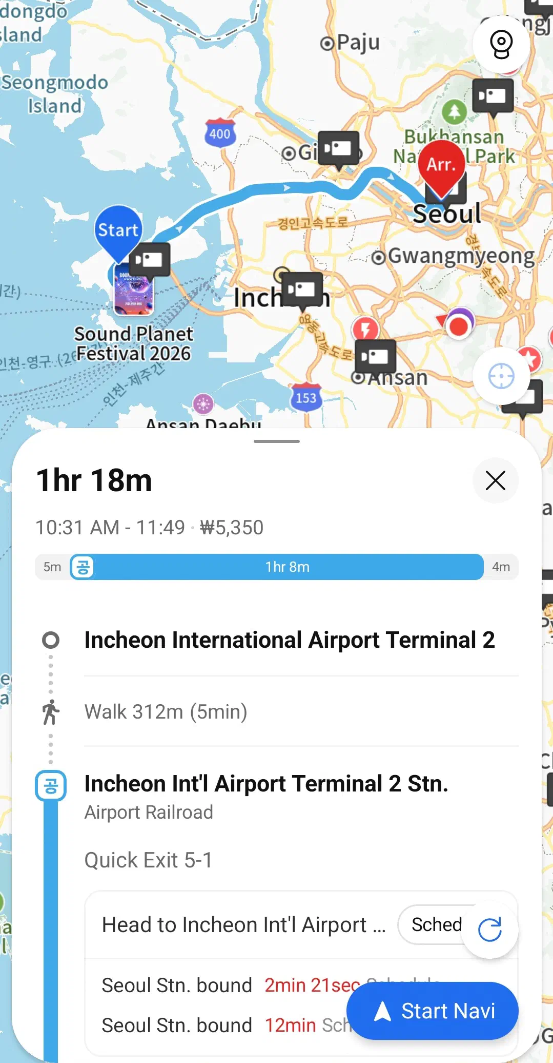
They tell you when the subway is arriving, and which car to stand at. Both apps show real-time train position and time to arrival, and Kakao Map flags which car number puts you nearest your transfer at the other end — the difference between a 90-second connection and a dash across the platform.
They tell you when the last one leaves. Makcha — the last train or bus of the night — ends a trip for a lot of visitors who didn’t check. Both apps show it on the same screen as the next arrival, so you see the cutoff before you need it.
They give you a real travel-time estimate, transfers included, not just a straight-line guess — useful for the actual question, which is usually “can I make it,” not “how far is it.”
They show you what Koreans actually rate, not what shows up for tourists. Restaurant and café listings on both apps carry ratings and review volume from the local user base — Naver in particular surfaces whether a place closes for a break in the middle of the day, which a tourist-facing review site usually will not tell you.
If you only install one, make it Naver Map. It is the stronger all-rounder — walking directions, subway routing and place search all read cleanly in English, which is the harder problem to solve than any single feature above. Kakao Map is worth adding on top rather than instead of it: its live bus tracking is a step ahead, and its restaurant listings go down to which floor a shop is on. Neither is essential the way Naver Map is — think of it as the one you add once the first app already has you covered.
Google Maps still handles public transit directions in English, which the old rules always allowed, so it is not useless — it is partial, and it is its own subject once you are actually on a train.
None of this needs a Korean phone number. Calling an actual taxi through an app like Kakao T is a separate question, and a different article covers what still needs one in 2026 and what no longer does.
Before you land
- Install first
- Korean eSIM — at home, on your own wifi, screenshot the QR
- Install second
- Naver Map — Kakao Map is worth adding, not required
- Public wifi covers
- Subway, buses, city parks, some public facilities
- Public wifi does not cover
- Sidewalks, alleys, most places outside Seoul, the moment you need it most
- Ask Kakao Map for
- Live bus position, which subway car to stand at, floor-level shop detail
- Ask Naver Map for
- English walking directions, opening hours and lunch breaks
Get the data before you land, install both apps while you still have reliable wifi to do it on, and public wifi becomes a bonus instead of a plan.
Quick answers
Does Seoul have free public wifi?
Should I use Google Maps, Naver Map, or Kakao Map in Korea?
Do I need a Korean phone number to use Naver Map or Kakao Map?
Checked 25 August 2026. Seoul public wifi’s coverage — subway trains and stations, city buses, large parks and welfare facilities — from the Seoul Metropolitan Government’s own service pages. Korea’s 4G/5G coverage figures and real-time bus and subway features on Kakao Map and Naver Map from current comparisons of both apps against Google Maps for Korea travel. The single-app recommendation reflects the same comparisons' consistent guidance: Naver Map as the default first install, Kakao Map as an optional add for live bus tracking specifically. Google’s Korea map-data restriction and its 2026 conditional approval are covered in full in our addresses article. App store and web links checked live 25 August 2026. Coverage and app features change — confirm before you travel.